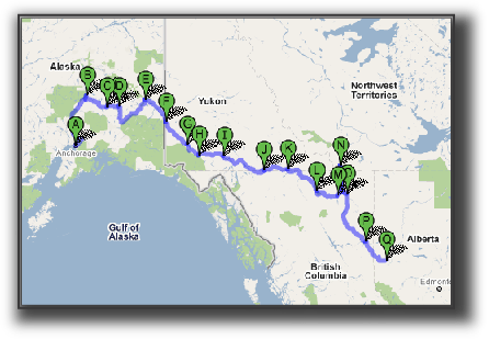
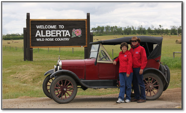
Fort St. John, British Columbia to Grande Prairie, Alberta
Miles Driven Today:
132 miles
Total Miles of Trip:  
2,269
Hours on the Road:  
6:00 hours
Started At:  
10:15 am
Stopped for the Day:  
4:15 pm
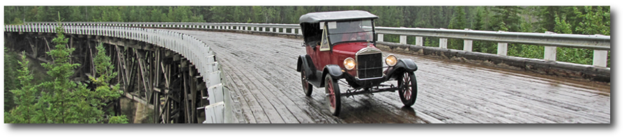
   After our two long days, we slept in a little and got a late start on our drive to Grande Prairie.  We were surprised at how busy the traffic was both coming toward us and going 
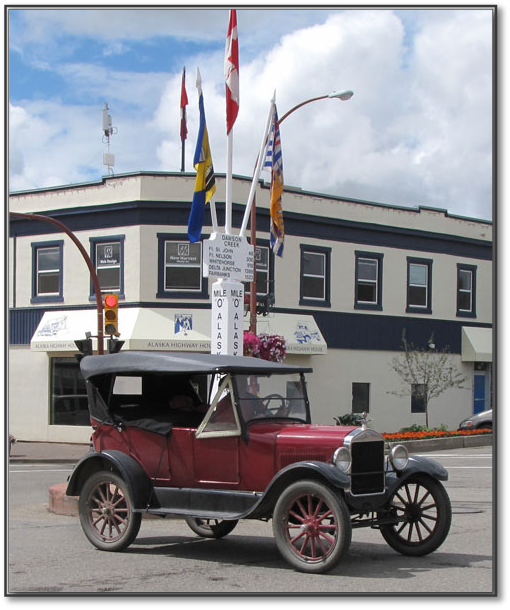
our way.  North of Dawson Creek, the Alaska Highway is the only highway.  There may be roads within communities but they don’t go elsewhere; if you are going cross-country, there is only one road to get you there.  
Driving it Home
Montana Majestic Mountain T Tour
On The Road Again
Yellowstone then Home
722header.psd
Day 29 - Thursday, July 22, 2010
Kiskatinaw River Bridge - Alaska Highway
Runs great...
  ....Drive it home.
Runs great...
      ....Drive it home.
Getting to Anchorage
26 Touring-sm.jpg
July 23.pdf
   Contact Us      About Ben & Nancy
45.jpg
 TTP Logo.gif
lilleker.gif
mtfcalogo.jpg
MTFCILOGO.gif
KC Warford logo.gif

    We drove into rain within the first 10 miles and, when we hit  the down hill slope at the Peace River Bridge in Taylor, it was coming down hard.  There is an 8% slope on that hill, ending in the metal grating of the 2,130 foot bridge.  (I have learned from Orrin Conklin, who is following our trip, that the metal grating reduces the amount of snow removal necessary to keep the bridges safe in the winter.  Thanks, Orrin.)  On the other side of the  river, there was an even scarier sight - a sign declaring that the next 4 miles contained grades ranging from 6-10% going uphill.  Fortunately, there was a passing lane most of the way up because we dropped down to 11 mph at one point.  But Ben wants me to mention that, with the Waford transmission, he only had to shift into Ford Low for about 100 yards.  Not that everyone was glad we were on the mountain but most were still waving as they passed.

    Seventeen miles south of Dawson Creek was a side road that put us on an original section of the Alaska Highway and gave us the chance to drive over the beautiful Kiskatinaw River Bridge, the only original timber bridge built during the construction of the Alaska Highway that is still in use today.  Please look at the structure of the bridge in the big photo below.  The wooden plank surface is slanted, like a race track, to give the vehicles better traction as they made the curve. It is also beautiful and well worth the few extra minutes it takes to follow the loop road back to the highway.

    Somehow, I had expected bands to be playing when we reached the Mile 0 marker.in downtown Dawson Creek.  Surely, we are not the only ones taking pictures of our car driving around the marker!  We also visited the Alaska Highway House, seen in the picture below, which is an outstanding museum about the unbelievable accomplishment that was the building of the Alaska Highway.  If you ever come here, in a T or not, take time to visit this museum.

    The road to Grande Prairie was extremely busy and, in spite of Ben’s efforts to take to the shoulder whenever possible, we did get a rather unfriendly honk from someone who resented us for slowing him down (our first in over 2,000 miles).  Although the land leading into town is largely agricultural, this is a city of 50,000 and we were glad to get off the road and to our motel.  We’ve gotten rather used to seeing sheep on the highway and, really, prefer them to the double trailers we were dodging today.
Car on bridge.jpg
Ben driving across  the Kiskatinaw River Bridge.  See the woode
Links to the Sponsors of this site.
CanolaField.jpg
We passed field after field of this lovely yellow flowering pla
0_MilePost.jpg
Ben at the Mile 0 marker in Dawson Creek,  This was the beginni
Alberta.jpg
Crossing into Alberta on the way to Grande Prairie, although we
Barn.jpg
A tranquil farm near the busy highway into Grande Prairie.