2007 Texas to Colorado Model T Tour
June 20th thru July 4th, 2007
joining the "Search
for the Mohigans Tour”
and the Model T
Club of Northern Colorado.
|
|
|
|
|
The official tour today called for us to go
up and over Rabbit Ears Pass, turn north on Hwy 14 through
Walden and go on into Wyoming, eventually coming to Saratoga.
Since part of this same route is going to be repeated in
reverse tomorrow, we decided before leaving Texas to take an
alternate route today. Ben had found some roads on the
map that looked promising (I can say that now; I was sure we
would never be seen again!). We mentioned our plans to a
young man at the gas station and he assured us that
“It’s a mellow road.” Instead of going
up Rabbit Ears, we went north out of Steamboat Springs and
turned right at the Seven-Eleven onto CR 129.
|
|
|
|
|
|
|
|
|
|
|
|
Click to Enlarge
|
|
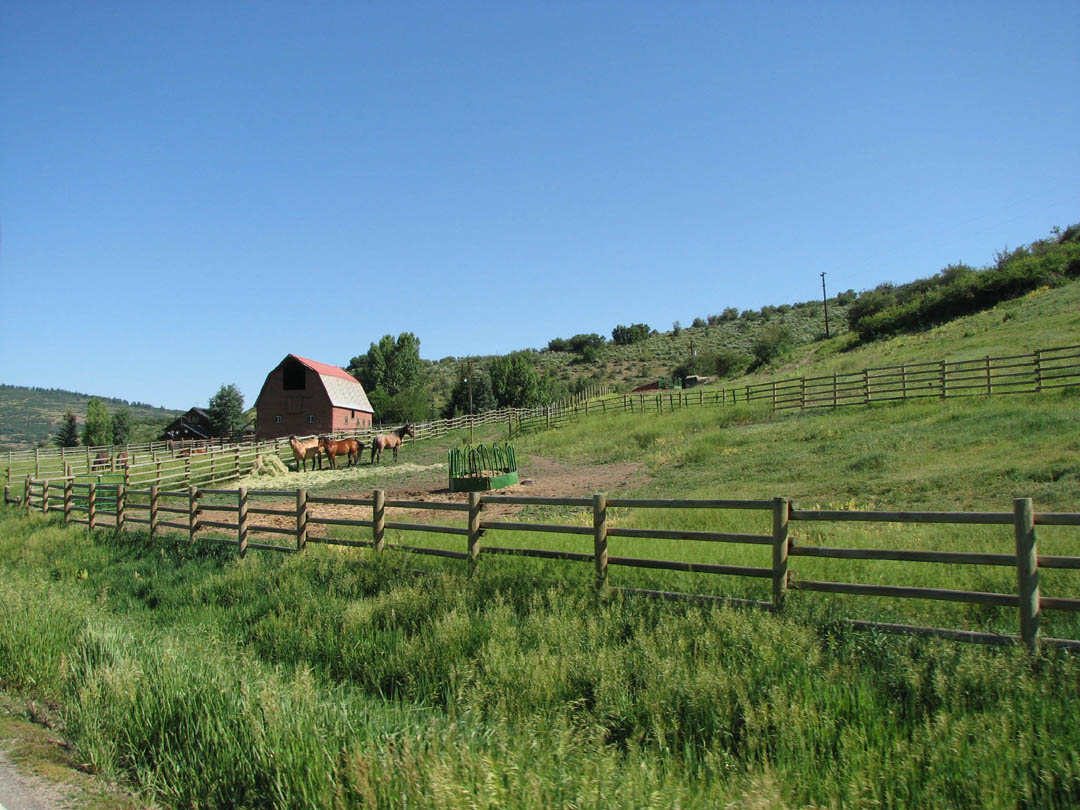
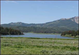
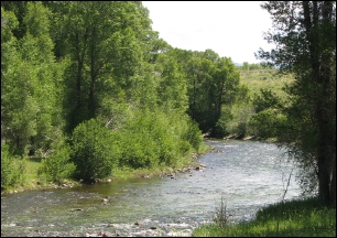
Right from the beginning, we were convinced
we had made the right decision. Picturesque farms and big
estates lined the road. A beautiful fishing stream ran
alongside for miles and, even though it went through private
lands, it appeared that much of it was open for public use.
After the first hill climb, we
stopped at the Clark Store. This is an old frame
building, featuring gas, fresh food, a bakery, a deli/cafe, a
liquor store, the post office, and a sporting goods store.
They also sold hunting and fishing supplies and licenses.
Pretty much your “beer, bait, and ammo” type
of place, except it was cleaner and smelled better. We
all bought homemade brownies and snacks and sat on the porch
admiring the scenery before we set out.
|
|
|
|
|
|
|
|
|
|
|
|
|
|
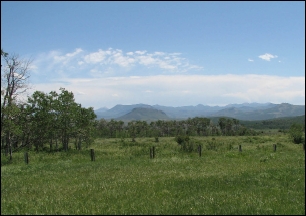
The scenery was spectacular on this road.
We were on rolling hills but the mountains were all
around us. There were a lot of cattle ranches, hunting
lodges, luxury weekend mansions, and western-style homes.
Some of the pastures had been irrigated and were used for
cattle or hay. A lot of it was rocky and scrub-covered
filled with columbine and daisies. This is a paved road
for all but the last 25 miles and
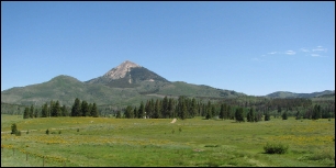
even that was a hard surface. Model
T’s ran on much worse roads when they were built with
much worse tires and brakes. I understand that some
people don’t like to drive their T’s on rough roads
but it would have been a great road for the main tour.
When the pavement ended and the gravel
began, we had a choice of staying on CR 129 or taking a
National Forest Service road recommended by a man at Clark
Store. We kept on the way we were going but I heard later
that about 6 cars from Indiana (and one from California) chose
the forest road. They described it as being a little
rough but also beautiful. You could tell who had been on
gravel roads later on at the hotel by the layer of dust
covering their cars.
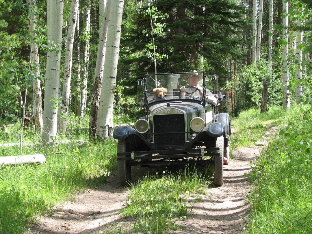
One section of our road today lead through
an aspen forest. They were so tall and the sun filtered
down in between the leaves . We came across this worn
path and couldn’t resist driving back into it.
We came around one corner and there in
front of us was this little “shepherd’s
cabin”. The horse is his transportation and, in the
woods surrounding the cabin, we saw a large flock of sheep.
By the time we realized what we were seeing, we had
already gone on. But it was just too interesting to pass
up. We did a U-turn, came back and shot the picture.
You can’t see it in this smaler version but there
is a woman in the doorway waving at us and her dog is on the
floor at her feet. Next time you are unhappy with your
job, remember that this could be your office.
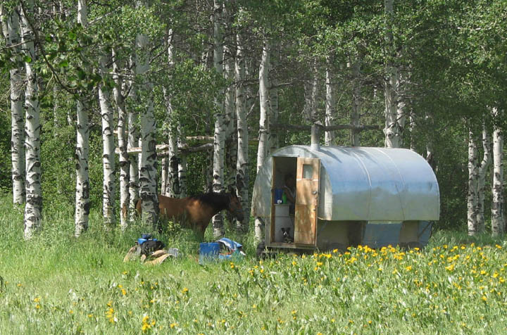
Click Picture to Enlarge
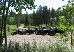
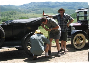
When we caught up with the rest of our
crew, we found them stopped on the side of the road
“airing” a tire on Austen’s car. Notice
who is doing the work and who is supervising. Note: The
bottle in Austen’s hand was not opened.
It was coincidental but they were
parked on a ridge above a magnificant ranch called the Three
Forks Ranch, referring to the river running through it.
The women and dogs, by the way, are
across the road and under the trees.
We started up and moved on with
Austen and Nicky in the rear. Because he has a stock
1915, he is slower
so no one was too concerned when he fell
behind. But when we stopped at a change in highway and he
didn’t show up, Ross and Bruce went back for him and
found that he had had a flat in that tire. He had been
changing it while we waited for them up the road.
I believe this is the Three Forks River
flowing down from Columbine, Colorado.
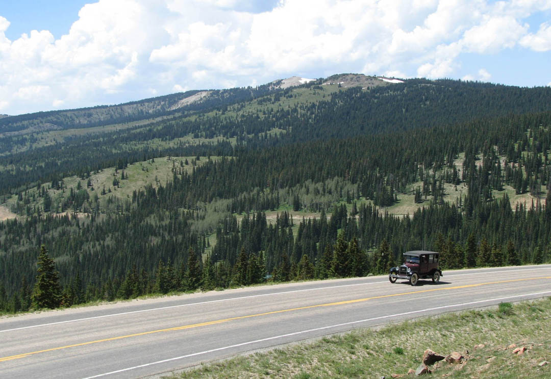
Before we could reach the town of
Encampment (where we hoped to have lunch), we would have to
climb the Battle Pass (9955 feet elevation). This was a
long and steep climb up with 7% grades going down. We had
driven nearly 100 miles over a lot of ups and downs but this
was a serious mountain in our way. At least we were back
on paved roads, at this point it was WY 70.
The summit of the Pass was also an
additional crossing of the Continental Divide.
We reached the summit first and Ben
climbed up on a rocky hillside to take pictures of the valley
below. Ross had switched cars with Austen and the Fordor
now contained Austen, Nicky, and Luke. Not long after
this, we rejoined the main tour for the drive into Saratoga.
We are staying at The Saratoga Inn, a lovely restored
historic inn with a great restaurant. As our friend Bob
Miller from New York always says, “It doesn’t get
any better than this.”